If there are ponds on the irrigation dept maps...
Residential zones in the master plan
Lack of consistency in details across irrigation, revenue, and master plans
How is the FTL determined?
In Hyderabad, there is some confusion regarding lakes and buffer zones. While the maps at the Irrigation Department show lakes, buffer zones, and water bodies, the same survey numbers appear as residential zones in the master plan. As a result, officials or staff at GHMC (Greater Hyderabad Municipal Corporation) or HMDA (Hyderabad Metropolitan Development Authority) who are newly appointed may not be fully aware of these issues. This was also the case with the recent incident at the Amar Society in Madhapur. It can be said that HYDRA has been acting aggressively without understanding such technical details.
Market experts say that there is a discrepancy in the method of calculating the FTL for lakes. The primary reason for this issue seems to be the differing maps related to lakes and buffer zones maintained by the Irrigation and Revenue Departments. The lack of consistency between these maps is causing problems, according to their opinions.
For instance, a detailed examination of the GPS coordinates related to the FTL survey numbers reveals that there is at least a ten-metre difference between the maps used by the Irrigation Department, Revenue Department, and local bodies. In the past, when officials from the Irrigation Department issued No Objection Certificates (NOCs) for constructing apartments, current officials find it easier to declare them as errors. Even though officials might state that a certain survey number falls entirely under the FTL, experts are often unable to accurately determine its exact placement on the ground.
The question of how to correctly represent the survey number on paper in relation to the FTL on the ground remains a big question. Who should inform Commissioner A.V. Ranganath about these discrepancies once they are documented on paper?
Officials from the Irrigation Department have not fully determined the FTL and buffer zones for lakes. As a result, every file had to be reviewed by them. It became a tradition to issue No Objection Certificates (NOCs) only if bribes were paid. This practice needs to be immediately stopped. The FTL and buffer zones at the ground level should be marked, and the corresponding survey numbers should be superimposed on Google Earth. These should also be included in the master plans. By doing so, the details in the master plans of the Irrigation, Revenue, and local bodies will be consistent. This will prevent any future issues and eliminate the need for special NOCs from the Irrigation Department.
Information related to FTL and buffer zones from the Irrigation, Revenue, and Municipal sectors should be made available to the public in the form of three layers in the public domain. Only then can permissions be denied to anyone attempting to build houses or structures in the lakes. The details regarding FTL and buffer zones should be accessible to the public in the public domain to prevent any encroachments on the lakes.
To prevent future encroachments on lakes, FTL maps should be digitised, and fencing should be installed around these areas. This will discourage anyone from attempting to encroach on the lakes or construct buildings in the buffer zones.
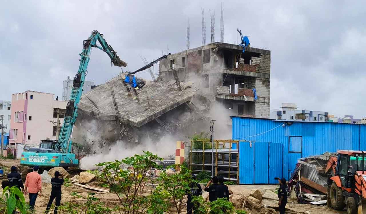
Don't Demolish Hastily..
THYDRA is issuing notices to even those apartments that received approvals from HMDA and GHMC. They are instructing the demolition of structures built on lakes. However, HYDRA needs to realise that these two local bodies do not grant permits easily. If it is indeed suspected that there are lapses in the approvals, the government should form a committee consisting of three or four experts to thoroughly review the permits granted by the local bodies. If incorrect permits are confirmed, those structures must be demolished without hesitation. There is no room for compromise here. Instead of rushing into demolitions, a scientific approach should be adopted to reach a final decision. We should consider how much natural wealth might be wasted if this process is not handled carefully.
In determining FTL, which maps are considered standard?
Apartments and houses that have encroached on lakes and ponds must be demolished. There should be no backtracking on this. However, how are the encroachments on lakes determined according to which maps? What is the validity of those maps? The HYDRA authorities need to carefully reconsider these aspects. For instance, who approved the FTL maps created by RV Associates in 2013? Who confirmed their authenticity? If there are errors in the previously made FTL maps, is there not a possibility that there might be errors in the maps created by RV Associates as well? If the current government believes that the maps made by RV Associates are flawless and entirely accurate, then it is essential to officially confirm and disclose that fact.
Encroachments on lakes can be prevented if this is done!
Telangana Chief Minister Revanth Reddy has taken the issue of lake encroachments seriously, but previous governments did not address it. As a result, the number of encroachers increased over the past 20 years. Moreover, if the Water Resources Department had placed a definitive plan for FTL and buffer zones in the public domain, there would not have been such problems. Identifying the boundaries of FTL and buffer zones and placing boundary markers could have prevented lake encroachments.
However, if the state government wants to address this issue now, it should set a cut-off date, physically survey the field, and coordinate with the Revenue, Irrigation, and Municipal departments to finalise the lakes and buffer zones. Details of these should be made public and provided to local authorities and the registration departments. Additionally, fencing should be installed around the lakes, and CCTV cameras should be set up to monitor the area continuously.